AgriScan
Multispectral crop analytics and variable-rate spraying plans.
Contact your local partner for pricing and licensing options
Overview
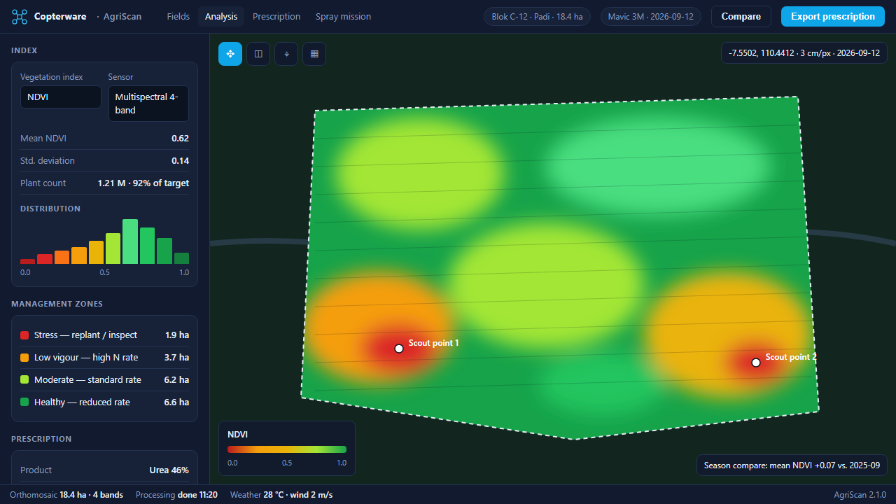
AgriScan processes multispectral drone imagery into vegetation indices, plant counts, and management zones for precision agriculture. NDVI and NDRE maps highlight stress before it is visible from the ground, and season-over-season comparison shows how each field is trending.
Zones export directly as variable-rate prescription maps and as spray missions for agricultural drones, so a scouting flight in the morning can drive an application the same day.
Key features
- NDVI / NDRE index maps
- Plant counting
- Prescription map export
- Spray drone mission generator
- Season-over-season comparison
Get AgriScan
Copterware software is sold and supported exclusively through authorized partners. Select your country to see the organizations that distribute this product and contact their office directly.
Release history
-
v2.1.0 Aug 25, 2026
Performance improvements and bug fixes.
-
v2.0.0 May 14, 2026
Major release with a redesigned interface.